Landscape Metrics Reloaded
Why and what to discover and to describe
What is the meaning?
Spatial patterns can be quantified using landscape metrics (O’Neill et al. 1988; Turner and Gardner 1991; Li and Reynolds 1993; He et al. 2000; Jaeger 2000; Kot i in. 2006; McGarigal 2014).
And well, we can calculate technically very complex metrics and indices, but what is the meaning?
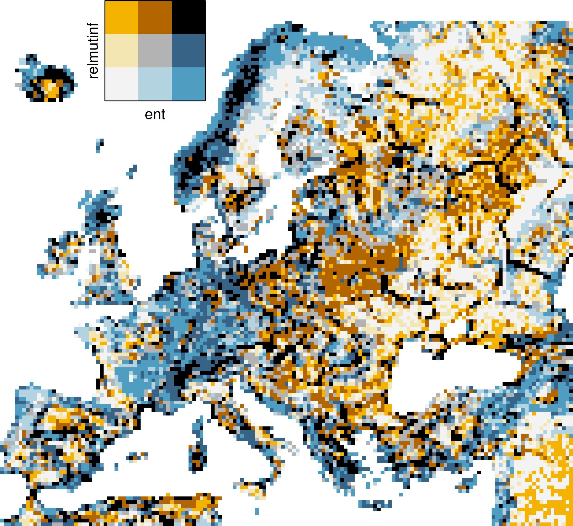
- Marginal entropy [H(x)] - diversity (composition) of spatial categories - from monothematic patterns to multithematic patterns
- Relative mutual information [U] - clumpiness (configuration) of spatial categories from fragmented patterns to consolidated patterns
Back to theory
So let’s go one step back:
Read the following section of Fragstats Manual and answer the following question:
What are the basic concept an meaning meaning of landscape metrics?
Form teams of two and please try to answer the following questions:
- What is now the specific purpose in scientific application?
- What can be expressed with them at all?
Now try to find an interpretation
- Marginal entropy [H(x)] - diversity (composition) of spatial categories - from monothematic patterns to multithematic patterns
- Relative mutual information [U] - clumpiness (configuration) of spatial categories from fragmented patterns to consolidated patterns
What are the fields of application?
Look at the first 30-50 hits on Google Scholar: Google Scholar Landscape Metrics
Work through the following questions:
- Try to sort the articles into meaningful groups.
- What are the most important questions and applications?
- Choose an article that interests you and summarize it in a 3-minute presentation, focusing on the significance of the metrics.
With this knowledge check Present and historical landscape structure shapes current species richness in Central European grasslands.
Try to find an answer:
- Why did they choose this specific indices?
- Can you identify the impact of specific metrics with respect to grassland?
- Discuss their Conlcusion with respect to landscape metrics
Ercercise
Please navigate to the landscapemetrics package.
Run the following tutorials with the example data of this course:
For the irregular vector data download the OSM data e.g. from Geofabrik and use the category landuse. Note you need to merge Niedersachsen and Sachsen-Anhalt
Addon
- Download the
FragStatstutorial Analyzing a single grid. - Run the tutorial once with
FragStatsand then use the data and indices for the same analysis with landscapemetrics instead.
<gisma 2024>
